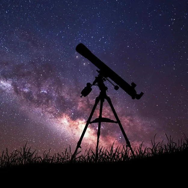


ExploreStars Envision User Manual
Explore Scientific PMC-Eight™ Telescope Mount Control
Version 2.4.0.0 • May 2026
- 1. Overview
- 2. Installation
- 3. Quick Start
- 4. Screen Layout
- 5. Setup Page
- 6. Target Page
- 7. Control Page
-
8. Star Seeker
- 8.1 Overview
- 8.2 Opening Star Seeker
- 8.3 FREE Mode
- 8.4 LIVE Mode
- 8.5 Push-To Mode
- 8.6 Mount Marker, Telrad & Lock
- 8.7 Solar-System Bodies
- 8.8 Magnitude Slider
- 8.9 Reference Lines & Zenith
- 8.10 Identifying Objects
- 8.11 Mirror Mode (Star Diagonal)
- 8.12 Equatorial vs Alt-Az
- 8.13 Coordinate Grids
- 8.14 Chart Settings
- 8.15 Data & Offline
- 8.16 Wikipedia Lookup
- 9. Calculators
- 10. Firmware Config
- 11. Star Alignment
- 12. Daylight Polar Alignment
- 13. Night Vision Mode
- 14. Networking
- 15. Supported Mounts
- 16. Troubleshooting
- 17. Credits & Data Sources
- 18. Trademarks, Copyright & Disclaimer
1. Overview
ExploreStars Envision controls Explore Scientific PMC-Eight™ telescope mounts from your phone or PC via WiFi, Bluetooth, or serial (USB). The companion Star Seeker sky chart is built in — a full offline planetarium-style view with sensor-driven push-to identification, tap-to-GoTo, and an integrated mount marker. No internet connection is required.
The app supports four ways of talking to your mount: two over WiFi (one for current ESP32 firmware, one for legacy modules), Bluetooth Classic on Android, and USB serial on Windows. Your commands are forwarded to the PMC-Eight's Propeller processor regardless of route. See Section 5.1 for picking the right one for your hardware.
Key features:
- 11,000+ object catalog with altitude-based visibility coloring
- GoTo, Sync, Tracking (Sidereal, Solar, Lunar)
- Star Seeker — offline live sky chart with FREE (drag/zoom) and LIVE (point-the-phone) modes, mount reticle, true-scale Telrad, planets, constellation lines and labels, four reference great circles, and tap-to-GoTo (see Section 8)
- Spiral search with video-remote-style transport controls
- Solar system targets: planets, Moon, Sun, and minor planets (Ceres, Vesta, Pallas, Juno)
- Meridian flip with auto-flip option
- 12 astronomy calculators
- Night vision mode for dark adaptation
- Multi-star alignment with 7-parameter mount model (PA, home offsets, level, cone)
- Geometry-graded star selection with nearest-star indicator
- Firmware configuration reader/writer
- Daylight polar alignment using phone compass and accelerometer
- Phone GPS auto-fills latitude and longitude on the Setup page
- Bluetooth Classic (SPP) connection on Android — no WiFi needed in the field
- Serial (USB COM port) connection on Windows desktop — direct to Propeller
- Connection settings remembered across sessions
- Works alongside Alpaca/ASCOM and planetarium software (e.g., Cartes du Ciel)
2. Installation

- Scan the QR code above or tap the download link — it lands on the latest GitHub Release page.
- Pick the asset that matches your device:
-
ExploreStars-Envision-android.apk— Android (sideload) -
ExploreStars-Envision-windows.zip— Windows desktop -
ExploreStars-Envision-pwa-server.zip— self-hosted PWA server (Win/macOS/Linux PC)
-
- For the APK: tap the file to install. Allow "Install from unknown sources" if prompted.
- If Google Play Protect warns you, tap "Install anyway".
3. Quick Start
- Power on your PMC-Eight mount and wait for WiFi to start (~10 seconds).
- Connect your phone to the mount's WiFi network (default SSID:
PMC-Eight, default IP:192.168.47.1). - Open ExploreStars Envision.
- On the Setup page, verify the IP address and tap CONNECT.
- Enter your latitude and longitude (required for accurate pointing).
- Go to the Target page, search for an object, and tap GOTO.
4. Screen Layout
The app has three persistent areas visible on every page:
4.1 App Bar
The top bar shows:
- App icon (yellow ES swirl) — tap to open the Explore Scientific website
- Title — "ExploreStars Envision"
- Help (? icon) — tap to open the built-in user manual
- Night vision toggle (moon icon) — tap to enter/exit night vision mode
- Connection indicator — green circle = connected, grey circle = disconnected
4.2 Telemetry Strip
Below the app bar, the telemetry strip shows real-time mount position. It updates every second when connected.
| Field | Format | Color | Description |
|---|---|---|---|
| RA | HhMmSs | Green | Current Right Ascension |
| DEC | ±D°M'S" | Green | Current Declination |
| LST | HhMmSs | Blue | Local Sidereal Time |
| Alt | Degrees | Orange | Altitude above horizon |
| Az | Degrees | Orange | Azimuth (N=0°, E=90°) |
| HA | ±H:MM:SS | Blue | Hour Angle (negative = east of meridian) |
| Status | Text | Gray | Mount status (Idle, Slewing, Tracking, etc.) |
4.3 Navigation Bar
The bottom navigation bar is the main way you move between screens. From left to right:
| Icon | Screen | Purpose |
|---|---|---|
| Target | Choose what to look at and send a GoTo. | |
| Control | Slew the mount, set rates, and center the target. | |
| Chart | The Star Seeker sky chart. | |
| Visibility | What is up tonight and when objects are best placed. | |
| Star Align | Build and refine the alignment model. | |
| Polar Align | Polar alignment. | |
| Calculator | Coordinate and utility calculators. | |
| Log | The running history of messages and events. | |
| Settings | Connection and app setup. This is where you connect to the mount, and the app opens here when it starts. |
The bar holds nine destinations. On a phone they do not all fit across the screen at once, so the row scrolls sideways; a soft fade and a small chevron appear on whichever edge has more icons to reveal. The screen you are currently on is highlighted, and the bar automatically scrolls that icon to the center whenever you change screens, so your current location is always in view.
5. Setup Page
5.1 Connection
The Connection dropdown picks how the app talks to your PMC-Eight. Choose the option that matches your hardware, fill in any fields it shows, and tap CONNECT. Your selection and field values are remembered across sessions.
Which option should I pick?
| Pick this | If your setup is… |
|---|---|
| WiFi (HTTP bridge) | The standard option for current PMC-Eight units — the ESP32 daughter board running the modern HTTP-bridge firmware. Use this unless you know you have one of the older modules below. |
| TCP (legacy mounts) | Older PMC-Eight units that shipped with an RN-131 WiFi module, an older ESP8266 daughter board, or an older ESP32 with firmware that predates the HTTP bridge. These all expose a raw-TCP serial bridge on port 54372. Also a valid choice on a modern ESP32 unit — raw TCP runs noticeably faster than the HTTP bridge. |
| Bluetooth | Android phone or tablet paired with the mount over Bluetooth Classic. No WiFi needed. Not available on iPhone (Apple restriction). |
| Serial (COM Port) | Windows PC connected to the mount with a USB-serial cable, or via a Bluetooth virtual COM port. |
WiFi (HTTP bridge) — current ESP32 firmware
The default. Enter the PMC-Eight's IP address — 192.168.47.1 for the mount's own AP network, or its LAN address if it has joined your home WiFi.
TCP (legacy mounts)
Direct raw-TCP connection to the mount's WiFi module. Use this for RN-131, older ESP8266, and older ESP32 units, or any time you want a faster path on a modern ESP32.
- Enter the mount's IP address.
- Leave the port at
54372— that's the standard for all PMC-Eight TCP connections, regardless of module type. - Tap CONNECT.
192.168.47.1 AP-mode IP, use the UFCT RESET RN131 function.
Bluetooth Classic (Android only)
Direct mount-to-phone Bluetooth — no WiFi needed. Ideal for field use where you want WiFi free for other things.
- Pair first — in your Android Bluetooth settings, pair with the PMC-Eight (it appears as a Bluetooth device).
- In the app, select Bluetooth from the Connection dropdown.
- Select the PMC-Eight from the paired devices list.
- Tap CONNECT.
Serial / USB (Windows only)
Direct USB cable to the PMC-Eight Propeller board. The most reliable connection — zero wireless involvement.
- Connect the PMC-Eight to your PC via USB.
- In the app, select Serial (COM Port) from the Connection dropdown.
- Select the COM port from the dropdown. Click Refresh ports if the port doesn't appear.
- Click CONNECT.
Serial via Bluetooth virtual COM port (Windows)
You can also reach the mount wirelessly from Windows by pairing the PMC-Eight as a Bluetooth device — Windows creates a pair of virtual COM ports for it. Useful when the mount is on a tripod across the room.
- Open Bluetooth settings from the system tray.
- Click Add device, then select Mice, keyboards, & more (not Audio).
- Click Show all devices to ensure Bluetooth Classic devices appear.
- Select PMC-Eight xxxx (the same identifier as your WiFi PMC-Eight network name).
- Open Device Manager → Ports (COM & LPT) to see which two COM ports Windows assigned.
- In the app, select Serial (COM Port) and try one of the two ports. If it doesn't connect, try the other.
| Field | Default | Description |
|---|---|---|
| Connection | WiFi (HTTP bridge) | Pick one of the four options described above. Options shown depend on platform: Bluetooth on Android, Serial on Windows, both WiFi options everywhere. |
| PMC-Eight IP Address | 192.168.47.1 |
IP of the mount's WiFi interface. Shown for both WiFi options. |
| Port | 54372 |
TCP port for the legacy-mount path. Standard PMC-Eight value — rarely needs changing. Only shown when TCP (legacy mounts) is selected. |
| PMC-Eight Bluetooth | — | Paired Bluetooth device. Only shown when Bluetooth is selected. Tap Refresh if the mount was recently paired. |
| COM Port | — | Serial port for USB connection. Only shown when Serial is selected on Windows. Tap Refresh ports to rescan. |
| Mount Model | iExos-100 | Determines encoder counts used for position calculations. Options: Losmandy G-11, iExos-100, EXOS-2. |
5.2 Site Location & Time
Enter your observing site coordinates. These are essential for accurate Alt/Az calculations, LST, and object visibility.
-
Latitude — positive = North. Enter as decimal degrees (
32.881) or DMS (32:52:52). -
Longitude — positive = East. Enter as decimal degrees (
-97.123) or DMS (-97:07:23).
Get GPS Location — tap this button to auto-fill latitude and longitude from your phone's GPS. The first time you tap it the browser or operating system will ask for location permission; allow it. If permission is denied or no fix is available, the fields stay as you last entered them and you can type the coordinates manually. The values are written immediately and saved like any other setting.
Local time and UTC are displayed for reference. Time comes from your phone's clock.
5.3 Tools
- Firmware Config — read/write PMC-Eight firmware settings (requires connection). See Section 10.
- Calculators — 12 astronomy calculators. See Section 9.
- Polar Alignment — daylight polar alignment using your phone's compass and accelerometer. See Section 12.
- Star Alignment — multi-star pointing model for GoTo accuracy (requires connection). See Section 11.
5.4 Display Language
ExploreStars Envision can show its interface in several languages. To switch:
- On the Setup page, find the Language panel.
- Tap the dropdown and pick a language. The UI updates immediately.
Currently shipped: English, 简体中文 (Simplified Chinese), Français, Italiano, Español.
Phrases that haven't been translated for the chosen language stay in English — nothing breaks, you just see a mix while a translation is in progress. Astronomy abbreviations (RA, Dec, Alt, Az, LST), catalog identifiers (M42, NGC 224, HIP 91262, etc.), and tech protocols (TCP, UDP, WiFi, Bluetooth) stay in their international Latin forms in every language.
Wikipedia links follow your language. Tap the Wikipedia button on a target and you'll land on the corresponding Wikipedia language edition: in Spanish that's es.wikipedia.org, in Chinese zh.wikipedia.org, etc. If your language's Wikipedia doesn't have an article for the target (more common for obscure stars in smaller-language wikis), the modal falls back to English Wikipedia.
6. Target Page
Use this page to find celestial objects and send the mount to them.
6.1 Catalog Search
Type in the Search field to filter the 13,500+ object catalog. Results appear in a scrollable list showing up to 200 matches.
- Class symbol at the start of each row — the same shape the Star Seeker chart uses to draw that class of object. Seeing the symbol both on the chart and in the picker trains your eye on the chart vocabulary. See the legend below for all symbols.
- Green text — object is above 10° altitude (good for observing)
- Gray text — object is below 10° altitude
- ● Blue dot — object has a thumbnail image that will display when selected
Tap any result to select it as your target. After selecting, a back arrow appears next to the search field — tap it to return to the previous search results and the same scroll position you left, no need to retype or clear the field.
Class symbol legend
The same symbols are used on the Star Seeker chart and in the picker rows. The dark cell here mirrors the chart's sky background so colours match the in-app appearance.
| Galaxy (G-S / G-E / G-Ir / G-QSO) | Spiral, elliptical, irregular, or quasar. Dusty-red ellipse with a center dot. | |
| Globular Cluster (GC) | Tightly bound spherical star clusters. Amber circle with cross. | |
| Open Cluster (OC) | Loose, gravitationally young clusters. Yellow dashed circle. | |
| Planetary Nebula (PN) | Shell ejected by a dying sun-like star. Teal disk with four external ticks. | |
| Emission Nebula (EN) | Glowing hydrogen / HII regions. Orange dashed square. | |
| Reflection Nebula (RN) | Dust scattering starlight. Blue dashed square. | |
| Dark Nebula (DN) | Opaque dust silhouettes. Grey dashed square. | |
| Supernova Remnant (SNR) | Expanding shell from an exploded star. Red dashed square. | |
| Star (AS) | Named single stars. Picker-only glyph (chart draws stars as size-scaled points). | |
| Double Star (DS) | Resolvable star pairs. Picker-only paired-dots glyph. | |
| Asterism (AST) | Recognizable star patterns (Big Dipper, Coathanger, etc.). Small grey ringed dot. | |
| Solar System | Sun, Moon, planets, dwarf planets, asteroids. Filled amber disk. | |
| Messier (catalogue marker) | Picker-only marker for the Messier-chip filter (Messier objects are real galaxies / clusters / nebulae — this badge identifies the catalogue entry, not the underlying class). |
Class filter chips
Below the search field is a row of toggle chips, each shown as the chart's symbol for that class. Tapping a chip filters the result list to that class; the status line below the chips always shows what's currently selected in plain text. Multiple chips combine with logical OR. Tap the same chip again to deselect.
The available chips and their behaviors:
- Messier — the M1–M110 catalogue. Sorts in catalogue number order by default.
- Galaxies — every G-S / G-E / G-Ir / G-QSO row. Sorts by visibility (highest in sky first) by default since galaxies have weak magnitude data.
- Globular Clusters — sorts brightest first (GCs have meaningful magnitudes).
- Open Clusters — sorts brightest first.
- Nebulae — a hand-curated showpiece set with three difficulty tiers (see below). This chip is exclusive: tapping it deselects the others, and tapping any other chip turns it off.
- Asterisms — star patterns, sorts by visibility.
- Solar System — Sun, Moon, planets, asteroids; live ephemeris coordinates.
To the right of the chip row is a small Sort column with three options: Brightness, Visibility, and Name. Visibility computes current altitude from your latitude/longitude and orders highest-in-sky first, continuing monotonically through below-horizon at the bottom. The first label adapts to the active chip — reads "Catalog #" when Messier is on, "Visibility" when Galaxies or Asterisms is on alone, "Brightness" otherwise. The center "Visibility" radio hides itself when the first label already means Visibility, since selecting either would do the same thing.
Position-based deduplication is automatic when any chip is on. A galaxy with multiple alias rows (NGC primary plus Caldwell plus several Herschel-program entries) collapses to a single canonical row in the picker; type a query directly to see the individual alias rows when needed.
Nebulae chip — observing-guide tiers
The Nebulae chip filters to a hand-picked set of 31 visual showpieces — the nebulae amateur observers actually look at — sorted automatically by visibility. When the chip is on, the Sort column at the right swaps to three difficulty checkboxes (Easy, Moderate, Difficult). Each is independent; toggle any combination on.
| Tier | Scope | Filters | Notes |
|---|---|---|---|
|
🟢 Easy Immediate visual success |
60–100 mm (2.5″–4″) minimum; improves with any aperture | None required; UHC or OIII enhances contrast | Bright, high-surface-brightness objects. Visible even in light pollution. Best for quick success after GoTo. |
|
🟡 Moderate Benefits from conditions or technique |
150–250 mm (6″–10″) recommended | UHC strongly recommended; OIII helpful on some targets | Lower contrast or larger objects. Darker skies and proper framing help. Filters often make the difference between “seen” and “not seen.” |
|
🔴 Difficult Challenging visual targets |
250 mm+ (10″+) preferred; larger aperture helps significantly | OIII often required; H-β critical for Horsehead and California | Low surface brightness, very large, or contrast-limited objects. Need dark skies, experience, and sometimes specific techniques (averted vision, careful field identification). |
The 31 curated targets:
- Easy (9): Orion (M 42), Dumbbell (M 27), Ring (M 57), Lagoon (M 8), Omega (M 17), Trifid (M 20), Saturn (NGC 7009), Little Dumbbell (M 76), Blinking Planetary (NGC 6826).
- Moderate (11): Owl (M 97), Eskimo (NGC 2392), Crescent (NGC 6888), Pacman (NGC 281), Veil — Western (NGC 6960), Pickering's Triangle (NGC 6979), Eastern (NGC 6992), Rosette (NGC 2237), Helix (NGC 7293), Eagle (M 16), Crab (M 1), M 78 (reflection — optional).
- Difficult (11): Horsehead (B 33), California (NGC 1499), North America (NGC 7000), Pelican (IC 5070), Flame (NGC 2024), Elephant Trunk region (IC 1396), Heart (IC 1805), Soul (IC 1848), Jellyfish (IC 443), Thor's Helmet (NGC 2359), Flaming Star (IC 405).
6.2 Nearby Search
The Nearby button is a toggle — tap to search for catalog objects within the specified radius of the mount's current position, tap again to hide the list. The button outline turns green when the nearby list is showing. Useful for identifying what you're pointed at. Adjust the radius (1–90°) with the spinner. Results also show blue dots for objects with images.
When the nearby list is showing, a small Sort control appears: results are ordered by distance from the mount by default, or tap Brightness, Visibility, or Name to reorder (tap the lit button again to return to distance). Changing the radius updates the list right away.
6.3 Solar System
Select a solar system body from the dropdown: Sun, Moon, planets (Mercury through Neptune), Pluto, and minor planets (Ceres, Vesta, Pallas, Juno).
- Blue text — above the horizon
- Gray text — below the horizon
Positions are computed offline using Meeus algorithms — no internet needed.
The tracking rate is set automatically: Solar rate for the Sun, Lunar rate for the Moon, Sidereal for everything else.
6.4 Custom Coordinates & Saved Targets
Tap the pencil icon next to the target heading to open the custom coordinate dialog. Enter RA and Dec manually in hours/degrees, minutes, seconds format.
- Choose J2000 if entering catalog coordinates (will be precessed to JNOW).
- Choose JNOW if entering current-epoch coordinates.
- Proper motion — optionally enter PM RA·cos(δ) and PM Dec in mas/yr for high-proper-motion stars.
- Name the target to save it permanently. Named targets are stored in the app and appear in the Saved Targets list on the Target page whenever the search field is empty.
Managing Saved Targets
To view your saved targets, clear the search field — the saved targets list appears automatically in the results area. Each entry has:
- Tap — select the target for GoTo/Sync.
- Edit — re-opens the custom coordinate dialog with the target's data pre-filled. Save with the same name to update it.
- Delete — permanently removes the target from saved storage.
Saved targets also appear in catalog search results when their name matches the search text. They are persisted across sessions and app restarts.
6.5 GoTo & Sync
- GOTO — slew the mount to the selected target. Tracking starts automatically after the slew completes.
- SYNC — improve your alignment model from a centered star (see What Sync Does, below).
What Sync Does
Envision works with you to build an effective mount model so your GoTo accuracy stays high throughout a session. Sync is one of the ways you build and improve that model. Rather than a one-shot "tell the mount it's pointing here," Sync improves your alignment model intelligently, and it protects a good model from bad data.
How to use it: center a real star (only a star contributes information to a sync) in the eyepiece, then tap SYNC. That's it — the app decides what to do with it.
What happens behind the scenes:
- First sync on a star — the app quietly records it ("Sync recorded — refining") and changes nothing yet. One star alone is never enough to act on.
- A second, different star (within about half an hour) — the app uses the pair to either gently refresh just your "home" position (similar to a traditional sync) or fold the star into the full model, whichever the measurements support. You'll see "Home offsets refreshed" or "Star added to model."
- The same star twice — the app says "Sync updated — pick a different star to refine." Two readings of one star don't tell it anything new; it needs two different stars.
- A poorly-centered star — the app may reject it rather than corrupt a good model. You won't have hurt anything; just revisit centering and try again.
Stars only. Sync (and alignment) work on point stars. If you try to Sync on a planet, the Moon, or a deep-sky object, you'll get a clear message ("Planetary sync not allowed", or "M32 is a Galaxy, not a star — sync only on stars"). Planets are excluded because their predicted positions aren't precise enough for fine calibration.
You generally don't need to think about any of this — center good stars, tap Sync, and the model improves over your session. For the full alignment workflow and a reference of the messages you might see, see Section 11.
Follow
For solar-system targets (Sun, Moon, planets, Pluto), a Follow switch appears below the GOTO/SYNC buttons. When enabled, the mount automatically re-GoTos at the body's recomputed position on a body-specific cadence. The mount's sidereal tracking rate is correct for stars and DSOs but is slightly off for solar-system bodies — they have their own apparent motion across the sky relative to the stars, so without Follow they slowly drift out of the eyepiece. The required re-GoTo cadence depends on how fast each body moves: the Moon at ~0.5°/hr is the fastest, the outer planets are nearly stationary against the stars at any given hour. Follow uses a per-body interval table so the slewer doesn't waste time on outer planets that haven't visibly moved or starve the Moon, which needs frequent corrections.
| Body | Re-GoTo interval | Approx. apparent motion |
|---|---|---|
| Moon | 7 seconds | ~0.5°/hr — fastest non-trivial body in the sky |
| Mercury | 25 seconds | fast near elongation; varies with orbital phase |
| Venus | 45 seconds | slower than Mercury; well within finder field at low power |
| Mars | 2 minutes | retrograde near opposition; slow otherwise |
| Sun | 10 minutes | ~15°/hr azimuthal but RA drift is small (0.04°/hr against stars) |
| Jupiter | 5 minutes | nearly stationary at high power timescales |
| Saturn | 8 minutes | slow; effectively held by sidereal tracking for short visual sessions |
| Uranus | 15 minutes | essentially stationary |
| Neptune | 20 minutes | essentially stationary |
| Pluto | 20 minutes | essentially stationary |
Follow stays on across page navigations: turn it on for the Moon, then go to Star Seeker or Control, and the mount keeps re-acquiring. It pauses while you slew the thumb pad and resumes on release. It also requires the mount to be tracking; if you stop tracking, Follow waits.
Follow remembers your intent across target changes. If you have Follow on for the Moon and then pick Mars, Follow stays enabled but won't auto-slew until you press GOTO on Mars (so you don't get a surprise slew the moment you tap a new target).
6.6 Alt/Az GoTo
Enter altitude and azimuth in degrees and tap GOTO Alt/Az to slew the mount to those coordinates. Useful for terrestrial targets or manual positioning.
6.7 Wikipedia Lookup
Once a target is selected, a Wikipedia ↗ button next to its name opens the Wikipedia article for that object inside the app. Tap → a full-screen overlay loads the mobile-Wikipedia page. The header has a red ✕ CLOSE to dismiss the overlay and a browser ↗ button to hand the article off to your default browser if you want to keep it open after closing the overlay.
The button is gated on internet availability. ExploreStars Envision otherwise works fully offline; this is the only feature that needs the internet. Without a working connection (probed at app start and on each foreground/online event), the button shows Wikipedia (offline) and is disabled.
The Star Seeker chart has the same Wikipedia affordance for selected chart objects — see Section 8.16 for the chart-side details and how the lookup resolves catalog identifiers like HIP 91262 or HR 2491.
7. Control Page
7.1 Tracking
Tap ON to start sidereal tracking (or the rate set by your target selection). Tap OFF to stop. The button is green when tracking is active, red when stopped.
Tracking rates:
| Rate | Used For | Multiplier |
|---|---|---|
| Sidereal | Stars, DSOs, planets | 1.0× |
| Solar | Sun | 0.997270× |
| Lunar | Moon | 0.966137× |
7.2 Meridian Flip
German equatorial mounts must flip when tracking past the meridian to avoid hardware collision.
- Pier side is displayed as "Pier: W" or "Pier: E" (orange text).
- Auto flip toggle — automatically flips when the mount tracks more than 2 minutes past the meridian.
- FLIP button — manually trigger a meridian flip. Enabled when connected, a target is selected, and HA ≥ -2 minutes.
Flip sequence: stop tracking → compute opposite pier motor angles → slew → wait for slew to complete → restart tracking.
7.3 Spiral Search
Spiral search slews the mount in an expanding spiral pattern around your target, useful for centering objects that are near but not in the eyepiece.
Setup
- TFOV — True Field of View in degrees. Set this using the Eyepiece TFOV or Imaging FOV calculator.
- Fraction — overlap between spiral steps (0.1 to 1.0). Lower values give more overlap.
- Step size = TFOV × Fraction (displayed in green).
Transport Controls
Controls are styled like a video remote:
| Button | Action |
|---|---|
| ⏮ | Skip to previous ring |
| ◁◁ | Step backward one position |
| ▶ / ⏸ | Play (auto-advance) / Pause |
| ▷▷ | Step forward one position |
| ⏭ | Skip to next ring |
A Stop button (red) appears during active search to cancel.
Manual stepping auto-pauses a running search. The search center initializes from the selected target.
7.4 Thumb Pad & Direction

The thumb pad is a large circular touch area for manual centering. Two ways to use it:
- Touch and hold on a direction dot. Press near one of the four cardinal dots (N / S top and bottom, E / W left and right) and hold — the mount slews in that direction at the current Slew Rate. Lift your finger to stop.
- Place your thumb in the centre and slide. Touch the centre crosshair, then slide toward a direction dot — the mount slews in that direction. Slide back toward the centre to stop, or lift your finger entirely. Sliding past one direction and back is a smooth way to nudge a target across the eyepiece without having to reposition between presses.
Only one axis moves at a time — the dominant direction wins. Lifting the finger always stops motion immediately.
- Deadband — small area in the center where no motion occurs.
- N / S — DEC axis motion.
- E / W — RA axis motion, symmetric relative to tracking (see Slew Rate below).
- Release — DEC stops, RA returns to tracking rate (sidereal, solar, or lunar as appropriate).
The Direction section also shows:
- Target Alt/Az (cyan) — where the selected target is in the sky.
- Mount Alt/Az/HA (orange/blue) — where the mount is currently pointing.
Below the thumb pad, three action buttons:
- GOTO — slew to the selected target.
- HOME — slew to the home/park position.
- SYNC — sync the mount to the selected target.
7.5 Slew Rate & Centering
When you GoTo an object it usually lands close but not perfectly centered. The rate slider on the Control and Star Alignment screens gives you the right tool for every part of that job. From slowest to fastest:
- Guide — press and hold a direction and the mount drifts very slowly (about a tenth of sidereal speed) until you let go. This is the smoothest way to walk a star into the crosshairs.
- Nudge 2″ — each tap moves the mount a fixed, tiny amount (about 2 arcseconds), no matter how long you hold the button. One tap, one nudge. Tap a few times to creep up on perfect centering. You may wish to use Guide to bring the target to dead center before a Sync.
- 1× sidereal / 2× sidereal — slow, steady continuous motion for general fine centering.
- Coarse and the faster rates — for repositioning and large moves.
8. Star Seeker
8.1 Overview
Star Seeker is the offline live sky chart built into ExploreStars Envision. Point-and-tap target selection, planet positions, alignment overlays, and a real-time mount marker.
The chart has two camera modes — FREE (finger drag and pinch zoom; ignores phone orientation) and LIVE (the chart rotates to match where the phone is pointing) — and one orthogonal interaction mode, Push-To (the chart's mount pip is driven by phone sensors instead of motor counts, for non-motorized mounts or motorized mounts with the clutches released; see §8.5).
The chart ships with about 5,000 stars (Hipparcos through magnitude 6), 10,800 deep-sky objects, all 88 IAU constellation outlines, plus the eight planets, Sun, Moon, and Pluto computed locally. No internet connection required at any point.
8.2 Opening Star Seeker
Tap the compass icon (rightmost) on the bottom nav bar.
First open after app launch:
- If the mount is connected, the chart centers on the mount's current sky position.
- If not connected, the chart centers on the visible celestial pole (NCP from northern latitudes, SCP from southern, NCP if no location is set).
Returning to the tab: the chart restores to wherever you left it — same camera position, same zoom, same mode (FREE or LIVE).
8.3 FREE Mode
The default. One-finger drag pans the chart. Two-finger pinch zooms in or out (FOV range 2°–160°). Tap an object to select it.
The bottom-left readout shows what's at the chart's current center: alt, az, RA, Dec, FOV, and the magnitude filter range.
8.4 LIVE Mode
Tap the top-right FREE button to switch to LIVE. On iPhone, accept the device-orientation permission prompt the first time. The chart rotates to match where the phone is pointing — aim the phone at the sky (or down the OTA), and the chart shows what's in that direction.
A complementary filter blends compass (long-term truth) with gyro (frame-to-frame stability). Filter stiffness adapts to motion and field of view: at rest zoomed in, the chart settles still; on the move zoomed out, it tracks freely.
ALIGN in LIVE
Phone compasses are imprecise, especially indoors and near metal. Aim the chart's screen-center reticle at a bright named star, tap ALIGN, confirm the candidate sheet (e.g. "Align on Capella? 3.2° from reticle · mag 0.1 · HIP 24608"), and the chart pins to truth at that star. The offset persists across app restarts. A red cal badge at the top of the chart shows what star you aligned on and how long ago.
What ALIGN does mathematically: it stores a single scalar azimuth offset — the difference between the phone's reported compass heading and the calibration star's true azimuth at the moment of confirmation. Every subsequent heading readout has that offset added. Tilt (altitude) comes from the phone's accelerometer / gravity vector and is trusted as-is, so ALIGN does not correct altitude errors. If the chart is consistently off in altitude, the cause is usually a phone-bracket pitch relative to the OTA tube; the fix is mechanical (re-clamp the phone parallel to the tube), not in software.
Note: chart ALIGN only adjusts the phone-sensor heading. It does not issue a PMC-Eight Sync, modify the mount alignment model, or move the motors. For mount-side accuracy, see Star Alignment (Section 11) and Daylight Polar Alignment (Section 12).
Is chart ALIGN important on a motorized mount? No, not critical. With a working motorized GoTo, the mount drives the OTA to a sky position; the chart is largely a planetarium for picking targets and reading off coordinates. The chart can be off by several degrees in LIVE mode and the mount still slews accurately. ALIGN is a quality-of-life affordance — if the LIVE chart is way off and you'd rather have it match the sky, tap ALIGN; if it's good enough for browsing, ignore it. (In Push-To Mode, by contrast, ALIGN is essential — the phone is the pointing reference.)
Sensor-Sign Flips (β, γ, α)
Below the ALIGN button, three small buttons flip the sign of each sensor axis (β±, γ±, α±). Defaults are correct for all tested iPhones and most Android phones. Only touch these if the chart appears mirrored on one axis.
8.5 Push-To Mode
Push-To turns the Star Seeker chart into a manual pointing guide. Phone orientation drives a live aim marker for where the optical tube is pointed; you pick a target (on the chart or on the Target page), the chart shows an arrow from your aim to the target with a live distance readout, and you physically push the telescope until the aim marker reaches the target. Designed for non-motorized mounts (Dobsonians, alt-az manuals, push-to-converted equatorials) and for motorized mounts with the clutches released for visual sweeping.
Boot Default and the Connect Switchover
Push-To is on at app start. The first launch of the day, before you've connected the mount, the app assumes you might be aiming a non-motorized scope — chart in push-to, sensor-driven aim marker, all motor GoTo buttons disabled and labeled GOTO (push-to) as a reminder.
Connecting the mount automatically turns Push-To off. Once a mount session is established the app assumes you're motorized; chart pip switches to motor counts, GoTo buttons enable. You can re-enable Push-To from Chart Settings any time — common reason: clutches released for finder-style sweeping with a connected mount.
Sensor Permission (iPhone)
iOS gates orientation sensors behind a permission dialog that requires a user gesture. Because Push-To boots on but the chart loads without a tap, the iPhone path needs one explicit user action to grant access. Two ways to do that:
- Tap ALIGN. ALIGN button always shows in Push-To. On the first tap from a cold-boot iPhone state, instead of opening the calibrate dialog, ALIGN triggers the iOS "Motion & Orientation Access" prompt. Tap Allow, and ALIGN reverts to its normal calibrate-on-target behavior on subsequent taps.
- Toggle Push-to in Chart Settings (gear icon). Toggling it off then on again also fires the permission prompt.
Android phones that support orientation events grant access transparently — no prompt; sensors flow as soon as the chart opens.
If your device has no orientation sensors at all (desktop browser, no-magnetometer Android tablet), the Push-to toggle in Chart Settings shows No motion sensors detected and stays disabled. The chart works as a planetarium.
How Push-To Works
With Push-To on and sensors flowing, the chart's orange Mount marker shows the phone's current aim direction (interpreted as where the OTA is pointed, assuming the phone is mounted parallel to the tube). The mount marker tracks live as you swing the telescope.
Tap any object on the chart — star, DSO, planet — and three things happen at once:
- The tapped object becomes the active push-to target. A green target glyph anchors at its sky position.
- The chart camera snaps back to follow your aim marker. As you push the telescope toward the target, the chart re-centers on the aim marker each tick; the target glyph stays anchored at its sky position so the relative geometry between aim and target stays visible.
- A yellow navigation arrow draws from the aim marker to the target, with a distance label (e.g.
Δ 12.3°, orΔ 18'at fine separation, oron targetbelow 12 arcminutes).
Push the OTA in the indicated direction. As the aim marker reaches the target glyph, the arrow shortens and finally collapses to on target with a green completion ring. The target object should now be in your finder / eyepiece.
Tap a different object to replace the active target. Pan/zoom to browse without losing the active target — the camera-follow pauses while you pan, then re-engages on your next tap. Tapping empty sky does not replace the target.
Turning Push-To off clears the active target. The chart reverts to motor-driven pip (or no pip if the mount isn't connected).
Picking Targets from the Target Page
You don't have to start from the chart. Picking a target on the Target page — via Find Target, Saved Targets, Solar System, Custom RA/Dec, or Nearby — sets it up for the chart automatically:
- Push-To on: the picked target becomes the active push-to target straight away. Open Star Seeker and you'll see the green target glyph at its sky position with the arrow drawing from your aim marker. No second tap on the chart needed — you already chose this target on the Target page, so the app skips the redundant confirmation step.
- Push-To off (planetarium / motorized GoTo use): the picked target appears as a yellow open ring on the chart. The chart centers on it. No vector arrow, no sensor follow — just a marker showing where your selection lives in the sky. Useful for orientation before a GoTo, or just to look around the field.
The chart also auto-unlocks (releases lock-to-mount) when a fresh target is picked on the Target page, so the new target is actually visible. You can re-engage LOCK from the chart any time.
The reverse flow works too: tap an object on the chart, switch to the Target page, and the picked target is already in the search box. The Nearby search there centers on it (instead of motor counts), so finding companions or related objects is one tap away.
ALIGN in Push-To
ALIGN in Push-To is essential, not optional. The phone's compass is the only thing telling the chart where the OTA is pointed; without calibration, the aim marker can be off by tens of degrees from sky reality and pushing toward the target arrow won't land on the actual target.
The workflow:
- Pick a bright star you can identify visually. Either pick it from the Target page (it'll be active immediately) or tap it on the chart.
- Physically center it in your finder / low-power eyepiece.
- Press ALIGN (top-right of the chart). Confirm "Calibrate push-to on [star]?".
- The chart records the offset between where the phone says it's pointing and where the star actually is in the sky. The offset persists across app restarts; the red cal badge at the top of the chart shows what you calibrated on and how long ago.
What ALIGN adjusts: a single azimuth (compass-heading) scalar. The phone's accelerometer-derived altitude is trusted as-is — gravity is an absolute physical reference and doesn't drift, while the magnetometer can be off by 10°+ from local declination, hard-iron interference, or hand-held disturbance. ALIGN corrects the dominant error and trusts gravity for tilt.
If the chart is also off in altitude after ALIGN, the cause is usually mechanical — the phone bracket isn't parallel to the OTA tube, so the phone's gravity-relative tilt doesn't match the OTA's tilt. The fix is to re-clamp the phone bracket parallel to the tube.
ALIGN does not issue a PMC-Eight Sync, modify the mount alignment model, or move the motors. It only writes to the phone-sensor calibration in local storage. If a motorized mount is connected, its alignment is independent of push-to ALIGN.
The ALIGN button is always visible while Push-To is on. It is greyed out until both sensors are confirmed working AND you have an active push-to target. The single exception is the cold-boot iPhone case described above, where ALIGN is tappable from the start (its first tap is the iOS permission gesture).
Push-To with a Motorized Mount Connected
If a motorized mount is connected and you re-enable Push-To from Chart Settings, the chart's Mount marker is sensor-driven (not motor-driven) so the chart reflects what your phone says, not what the motors say. Motor telemetry continues to run in the background (top app-bar RA/Dec strip still shows mount position).
While Push-To is on, every motor GoTo button across the app is disabled and labeled GOTO (push-to) — on the Target page (main GoTo, Alt/Az GoTo, SYNC), on the Control page, and on the chart itself. Push-To is a manual-pointing UX; issuing a motor slew while in push-to would put the chart pip out of sync with the motors. Turn Push-To off in Chart Settings to re-enable motor GoTo.
8.6 Mount Marker, Telrad & Lock
Mount Marker
When the mount is connected, an orange marker sits at the mount's actual sky position regardless of mode — a single open ring with four short stub lines just outside it (no center crosshair, so the target object stays unobscured). The marker updates in real time as the mount slews and tracks. If it's off-screen, drag the chart to find it.
Telrad Reticle (screen center)
Three faint red rings at the screen center represent a real Telrad finder with rings at 0.5°, 2°, and 4° radii (so 1°, 4°, 8° in diameter). They scale with the chart's field of view, so what you see in the rings is what would land in the corresponding Telrad ring at the eyepiece. At extreme zoom-out the outer ring clamps to a minimum visible size while keeping the inner rings proportional.
At narrow FOVs (15° or less) each ring is also labeled at the top with its diameter (1°, 4°, 8°) so you can quickly judge eyepiece-field comparisons against the catalog object sizes shown elsewhere in the app.
Lock to Mount
In FREE mode with the mount connected (and Push-To off), a small orange button appears top-right showing the chart's current lock state — UNLOCKED or LOCKED. Both labels are adjectives describing what the chart is doing right now; tapping the button toggles the state.
When LOCKED, the chart's center is glued to the mount — the chart auto-pans as the mount tracks across the sky. Any finger drag or pinch automatically releases the lock; the label flips to UNLOCKED and you're back to free panning. Tap again any time to re-engage.
LIVE mode and Push-To both hide the lock button (the camera is already driven by phone orientation in those cases; locking to the mount would conflict).
Lock state persists across app restarts. If you reopen the app while the mount is connected, the chart re-engages the lock automatically. If the mount isn't connected at launch, the flag is held and the lock engages as soon as the mount reconnects.
Picking a new target on the Target page auto-releases the lock. Without that, the chart would briefly show the new target during init then snap back to the mount, hiding what you picked. After picking, the chart starts unlocked so you can see the target marker; re-engage lock manually if you want to follow the mount again.
Camera FOV Box
If you image — or just want to know what a camera would frame — Star Seeker can draw a cyan dashed rectangle showing your camera's field of view on the sky, centered on the mount marker. Set it up once on the Camera FOV calculator (§9.1): pick your camera and enter your scope's focal length, and the box appears at the mount's current pointing so you can see whether your target fits the frame before you slew.
The rectangle is oriented the way a polar-aligned equatorial mount actually holds the camera: with no rotation, the long edge runs east–west along the lines of right ascension. If you use a camera rotator, enter its angle and the box turns to match. The label above the box shows the field size (for example Cam 1.70°×1.13°) and the rotation angle when one is set.
Turn the box on or off from either the calculator's Show camera FOV on sky chart switch or the chart's gear panel (Reticle & Markers → Camera FOV box) — the two stay in sync. The box only draws while the mount is connected, since it rides on the mount marker.
8.7 Solar-System Bodies
Sun, Moon, Mercury, Venus, Mars, Jupiter, Saturn, Uranus, Neptune, and Pluto are drawn at their current sky positions, each as a colored filled disk with a name label:
- Sun bright yellow · Moon light grey · Mercury warm grey · Venus cream-white
- Mars orange-red · Jupiter tan · Saturn pale gold
- Uranus pale cyan · Neptune deep blue · Pluto warm tan
Tap any body to select it as a target — same as tapping a star or DSO.
8.8 Magnitude Slider
A small dual-thumb slider on the right edge of the chart filters what's shown by magnitude. Drag the top thumb down to hide faint stuff; drag the bottom thumb up to hide bright stuff. The shaded band between the thumbs is the visible range.
- Range: −3 (brighter than any catalog entry) to 14 (deeper than the catalog reaches).
- Default: −3 to 9 (everything brighter than mag 9 visible).
- Step: 0.5 magnitudes.
- Applies to both stars and DSOs. DSOs without a recorded magnitude in the catalog (often named objects with no integrated brightness listed) are treated as ~mag 8.5, so they're filtered out alongside stars when you drag the faint cap below 8.5.
- Solar-system bodies are exempt — Sun, Moon, and planets always show regardless of slider position.
The bottom-left readout shows the current band. Stars and DSOs hidden by the slider are also un-tappable, so you can't accidentally select something you can't see.
8.9 Reference Lines & Zenith
Beneath the stars, DSOs, and constellation stick figures, Star Seeker draws four reference great circles plus a zenith marker. Each great-circle line is self-labeled — an italic yellow text tag rotated to follow the line's local direction at the on-canvas point closest to chart center.
- Ecliptic — yellow short-dash. The Sun's apparent path through the sky over the year. Planets always sit close to it.
- Local meridian — yellow solid. The great circle through your zenith and the celestial poles, drawn continuously around the celestial sphere as two RA half-circles 12h apart. Objects on this line are "in transit" — at their highest right now.
- Celestial equator — yellow long-dash-dot. The great circle at Dec = 0°, the natural reference line for any equatorial mount.
- Galactic equator — yellow dotted. The plane of the Milky Way disk transformed into J2000 equatorial coordinates. Useful for orientation when the Milky Way is overhead.
All four lines are bright yellow, distinguished purely by dash pattern — the high luminance survives the night-vision hue shift toward red, and the dash pattern carries the identity even when colors collapse.
Constellation Lines & Names
Soft blue stick figures connect the named stars of all 88 IAU constellations. Tap the yellow LINES button (top-right) to hide or show them. The four reference great circles above stay visible regardless of LINES state.
When LINES is on AND the chart's field of view is wide enough (20° or more), each constellation also gets an italic dim-blue name label drawn near its star-vertex centroid. At narrower FOVs the constellation names suppress themselves to keep zoomed-in views uncluttered.
Zenith Marker
A small yellow open ring with a "Z" letter sits at your local zenith — RA equal to local sidereal time, Dec equal to your latitude. It's a visual orientation anchor for the chart, not a clickable target.
8.10 Identifying Objects
Center Label
When the chart's field of view is 60° or less, whatever object sits closest to the chart center (within the inner Telrad ring — about 0.5° of screen center) gets a small white-on-dark label drawn just to its right. Pan around with finger drag and the label hops to whichever object is now central. Pan past 60° FOV and the label suppresses itself.
Label format depends on the object type:
- Constellation-line node stars use Bayer designations when known (α CMa, β Tri, π³ Cyg, ...), Flamsteed numbers when only those exist (38 Lyn, 7 Cam), or "HIP <n> ABBR" for catalog-faint nodes. Every constellation node has a label.
- Other named stars use their Bayer form if available (e.g. α CMa for Sirius), else a proper name, else "HIP <n>".
- DSOs use their catalog name (M31, NGC 2237, ...).
- Solar-system bodies use their body name (Mars, Jupiter, ...).
Tap to Select & GoTo
Tap any object — star, DSO, or planet — and a panel slides up from the bottom with the name, RA / Dec (in JNow, matching the mount and telemetry frame), Alt / Az for your site at the current time, magnitude, and type. A small green marker (filled disk with four diagonal ticks) stamps the chart at the tapped position so you can confirm the tap landed on the intended object before slewing. The marker stays put while you pan or zoom; it clears when you dismiss the panel (the × button) or after GoTo. The selection also flows to the Target page automatically: when you navigate there, the same target is already selected with full RA / Dec / Alt / Az populated and ready for SYNC, custom edits, or saving.
Tap GoTo in the chart panel to slew the mount to it; tracking starts automatically. The button is disabled when the mount isn't connected.
8.11 Mirror Mode (Star Diagonal)
Tap the MIRROR button (cyan, top-right) to flip the chart left-right. Use this when observing through a star diagonal (SCT or refractor) — the eyepiece view is mirrored, and turning MIRROR on makes the chart match what you see in the eyepiece. Geometry mirrors uniformly: stars, DSOs, constellation lines, the Telrad reticle, the mount marker, and reference great circles all flip together. Text labels stay readable left-to-right at their mirrored positions, so identification still works normally.
Pan and tap automatically compensate — dragging right still moves what you see right, and tapping a star still selects what's actually under your finger. The setting persists across app restarts: if you observe with a star diagonal regularly, turn MIRROR on once and it stays on.
8.12 Equatorial vs Alt-Az
Tap the EQ / ALTAZ button (white, top-right) to switch between two display frames:
- EQ (default) — celestial north is up. The local meridian is a roughly vertical line through chart center; the celestial equator is a fixed great circle. Stars stay put as time passes (the meridian line sweeps across them). This is the conventional astro-atlas view and matches how most planetarium software draws charts.
- ALTAZ — the zenith is up. The chart shows the sky the way you'd see it standing on the ground looking around: zenith overhead, horizon at the chart edge if FOV is wide enough. Stars sweep east-to-west across the chart at sidereal rate as time passes. Useful for naked-eye matching, alt-az mounts (Dobsonians, EXOS Nano AZ), and "what's overhead right now" planning.
Switching modes is reversible and lossless — the camera stays pointed at the same sky position. In ALTAZ, dragging right pans west (drag-right shows what was to the right), and dragging down points the camera higher in altitude. Tap-to-select, the Telrad reticle, the mount marker, lock-to-mount, and MIRROR all work normally in both modes.
In LIVE mode the projection toggle is mostly cosmetic: the camera basis is already driven by the phone's orientation (zenith-up by physics).
The setting persists across app restarts, so once you pick a frame you don't have to re-pick on next launch.
8.13 Coordinate Grids
Two optional grid overlays give the chart a positional context. Both are on by default and toggleable via the gear icon (§8.14). Both are FOV-adaptive — wide views show a coarse grid (e.g. 30° / 2 h spacing), narrow views show a fine grid (down to 5′ / 20 s spacing).
RA/Dec grid
Cool blue-white. Parallels of declination (small circles around the celestial poles) and half-meridians of right ascension. Drawn in the current-epoch (JNow) frame so the grid lines align with the local meridian and the bottom-left readout. Edge labels: declination at the left and right canvas edges, right ascension at the bottom edge. RA labels are formatted as hours-and-minutes (e.g. 0h 40m) so they read at a glance against the LST in the top telemetry strip.
Alt/Az grid
Warm tan. Parallels of altitude (rings around the zenith) and meridians of azimuth (great circles from horizon to zenith). The four cardinal directions get letter labels — N / E / S / W — instead of numeric azimuths. Alt labels at the left/right canvas edges, az labels at the bottom edge. In ALTAZ projection mode the alt parallels appear roughly horizontal and the az meridians vertical — this is the natural use case. In EQ mode the same lines appear as curves centered around the zenith (which moves through the equatorial frame as time passes).
Density management
- Lines thin out automatically near the celestial poles (for the RA grid) and near the zenith (for the alt/az grid). At those geometric singularities the meridians converge — without thinning the chart would clutter into lines an arcminute apart. Thinning only kicks in when the visible line count exceeds ~7 across the chart.
- Labels follow the lines. At wide FOV (> 30°) every line is labeled. At medium FOV (5°–30°) every other line is labeled. Labels are also suppressed in the upper third of the canvas where lines converge near a pole or zenith — that's the cluster zone where labels would overlap.
- The right-side labels are suppressed where they would overlap the magnitude slider.
If you find one grid distracting in a particular projection mode, turn it off in Chart Settings; the toggle persists.
Change grid with projection
An optional setting in Chart Settings (under Coordinate Grids) named Change grid with projection ties the active grid to the chart's projection mode automatically. With it on:
- In EQ projection, only the RA/Dec grid renders — the Alt/Az grid is suppressed regardless of its individual toggle.
- In ALTAZ projection, only the Alt/Az grid renders — RA/Dec is suppressed.
The individual line/label toggles still act as filters within the chosen grid (e.g. you can keep RA/Dec lines but hide their labels). When the override is off, both grids honor their own toggles independently. Default is off, so the chart's existing behavior is preserved unless you opt in.
8.14 Chart Settings
Tap the gear icon (⚙) at the top-right of the chart to open the settings panel. Each row toggles one chart layer: tap ON / OFF and the chart redraws immediately.
The panel is organized into one mode toggle and five layer sections:
- Mode — the Push-to toggle (see §8.5). Distinct from the layer toggles below it because Push-To changes interaction behavior (tap path, ALIGN, camera follow), not just visibility. Disabled and labeled "Checking sensors…" or "No motion sensors detected" until the chart's sensor probe completes.
- Position — choose whether the mount marker and the RA/Dec readout show the model-corrected "true sky" position or the raw, uncorrected position. Available once you have at least a two-star alignment model; the change takes effect on the next position update.
- Reference Lines — the four yellow great circles (ecliptic, celestial equator, galactic equator, local meridian) each with separate line and label toggles, plus the zenith marker (Z). Once you know the meridian by sight, turn its label off without losing the line.
- Coordinate Grids — RA/Dec grid + labels, Alt/Az grid + labels.
- Catalog — stars, DSOs, constellation lines + labels (the LINES top-right button toggles both as a unit), planets + labels.
- Reticle & Markers — Telrad rings + diameter labels, mount marker, camera FOV box (§9.1), center-of-field label.
- Display — the bottom-left FOV/mag/alt/az/RA/Dec readout.
Reset restores every layer to its default-on state. Done dismisses the panel; tapping outside the panel also dismisses it.
All settings persist across app restarts, alongside mirror, projection mode, and lock-to-mount state. Configure once, and the chart looks the way you want it from then on.
8.15 Data & Offline
All chart data — star catalog, DSO catalog, constellation lines, and the planetary ephemeris — is bundled with the app and cached by the service worker. Star Seeker works exactly the same on home WiFi, on the mount's AP network, or in airplane mode at a dark-sky site.
8.16 Wikipedia Lookup
Star Seeker has two ways to open the Wikipedia article for a chart object:
- Selection panel — in FREE / LIVE mode, tapping an object pops a panel at the bottom of the chart with the object's name, RA / Dec (in JNow), Alt / Az, and a Wikipedia ↗ button.
- Chart top-cluster button — the leftmost button on the second row of the top-right control cluster shows a small W icon. Visible whenever a chart target is in play (selected via tap, or active push-to target). This is the only Wikipedia entry point in push-to mode, since push-to does not open the selection panel. It stays available for the current target after a GoTo, so you can read up on the object you just slewed to.
Both buttons open the same full-screen modal as the Target-page link. An internet connection is required (the button shows Wikipedia (offline) when the connectivity probe has failed).
Catalog identifier resolution
Star objects are referenced by many overlapping catalog schemes — Hipparcos (HIP), Yale Bright Star (HR), Henry Draper (HD), Smithsonian (SAO), Gliese (GJ), Bayer letters, Flamsteed numbers, proper names. Wikipedia's article naming is inconsistent across these. ExploreStars Envision routes the lookup through several mechanisms so the modal lands on the right article whenever possible:
| Input pattern | How it's resolved |
|---|---|
M31, M42, M 042
|
Expanded to Messier_31, Messier_42 … which Wikipedia auto-redirects to the proper article (Andromeda Galaxy, Orion Nebula). |
NGC 224, IC 5070, NGC1039
|
Direct article path with normalized spacing. |
HIP 91262, HR 2491, HD 172167, SAO 67174, GJ 411, BD…, TYC…, FK…, PPM…
|
Wikipedia's I'm Feeling Lucky search endpoint (uses Wikipedia's own redirect table). In parallel, Wikidata is queried for the catalog cross-reference; if Wikidata knows the code maps to a specific article, the modal upgrades to that article (you may briefly see the search page before it jumps). |
Bare Bayer-letter forms like i Persei, h Cas, k Per
|
Same path as HIP/HR/HD — Wikipedia's redirect table or Wikidata, whichever resolves first. |
Proper names like Vega, Sirius, Andromeda Galaxy, Iota Persei, Beta Persei
|
Direct article path. One fewer redirect than search. |
For obscure catalog codes Wikipedia and Wikidata both lack — most middling-bright stars don't have their own articles — the modal falls back gracefully to a Wikipedia search-results page rather than a 404. The article you want may be linked from the search results.
HR 2491 resolves to "Sirius"; HIP 91262 resolves to "Vega"; i Persei resolves to "9 Persei" (Wikipedia titles many lowercase-Latin Bayer-letter stars by their Flamsteed number). The modal's header shows what you searched for; the article body shows Wikipedia's chosen title.
9. Calculators
Thirteen astronomy calculators are available from the Setup page. Select a calculator from the dropdown, enter values, and tap Compute. The page reopens to whichever calculator you last used.
| # | Calculator | Description |
|---|---|---|
| 1 | FOV per Pixel | Angular size of one pixel given focal length and pixel size |
| 2 | FOV (Imaging Train) | Total field of view for a camera sensor |
| 3 | Optimal Sensor Size | Sensor dimensions needed for a desired FOV |
| 4 | Max Resolution | Maximum focal length for a given sampling rate |
| 5 | Useful Magnification | Min/max useful magnification for an aperture |
| 6 | Pixel Matching | Evaluate pixel scale vs. seeing conditions |
| 7 | Exit Pupil | Exit pupil diameter for a telescope/eyepiece combination |
| 8 | Eyepiece TFOV | True field of view for an eyepiece (saves to spiral search TFOV) |
| 9 | f/ratio | Focal ratio from focal length and aperture |
| 10 | Eyepiece Projection | Effective focal length for eyepiece projection imaging |
| 11 | Dawes & Rayleigh Limits | Theoretical resolving power for an aperture |
| 12 | Field Rotation (Alt-Az) | Field rotation rate for alt-az mounted telescopes |
| 13 | Camera FOV (Chart Box) | Camera field of view from sensor + focal length; draws a framing rectangle on the sky chart (§9.1) |
9.1 Camera FOV (Chart Box)
This calculator works out the field of view your camera sees through the telescope and draws it as a rectangle on the sky chart, so you can frame a target before slewing to it.
- Camera — a two-step Maker → Model picker covering ZWO, QHYCCD, Player One, Atik, ToupTek/Altair, SBIG, Starlight Xpress, Moravian, and DSLRs, plus a Generic list of standard sensor formats (full-frame, APS-C, micro 4/3, the 1″ / 1.8″ / 2.3″ family, and so on). Choose Custom to type a sensor's width and height in millimeters directly.
- Scope focal length — your telescope's focal length in millimeters.
- Barlow / reducer — a multiplier on the focal length: greater than 1 for a Barlow (narrower field), less than 1 for a focal reducer (wider field). Leave it at 1 if you use neither.
- Rotator — if you have a camera rotator, enter the position angle the way catalogs list it: degrees measured from north toward east. 0° puts the long edge north–south, 90° makes it east–west. Look up an object's angle — the Andromeda Galaxy, for instance, frames well around 35° — and the box matches that orientation.
Tap Compute and the result shows the field of view in degrees, plus the image scale in arcseconds per pixel for cameras with a known pixel size. Your camera and scope settings are remembered between sessions, so you only set the rig up once.
The Show camera FOV on sky chart switch turns the on-chart rectangle on or off; it mirrors the chart's own Camera FOV box toggle, so changing either one updates both. See §8.6 for how the box looks and behaves on the chart.
10. Firmware Config
Read and write PMC-Eight Propeller firmware settings. Access from Setup → Firmware Config (requires connection).
- Tap Read Config from Mount to load current settings.
- Modify settings as needed.
- Tap Write to Mount to save changes.
Available Settings
| Section | Settings |
|---|---|
| Mount Type | 16 mount models (iExos-100, G-11, EXOS-2 variants, etc.) |
| Communication | Baud rate (read-only), IP protocol (TCP/UDP) |
| Tracking Defaults | Hemisphere (N/S), sidereal drive on boot, track on loss of comms |
| Guide Rates | RA and DEC guide rates (0–100%) |
| Motor Current | Tracking and slewing current (mA) |
| WiFi | Channel (1–11), WiFi module type (read-only) |
| ST4 | ST4 guide port enable/disable, type (read-only) |
11. Star Alignment
Build a multi-star pointing model that corrects GoTo accuracy for polar alignment error, home position offsets, east-west level error, and cone error. Access from Setup → Star Alignment (requires connection).
How important is mount alignment? For ExploreStars Envision as typically used — a planetarium chart for picking targets and tapping GoTo — mount alignment is a nice-to-have, not a necessity. A GoTo with rough alignment usually lands the target inside a low-power eyepiece field, which is good enough to identify and center manually. The pointing model in this section becomes worth the time mainly when you're chaining many targets without re-centering between, doing astrophotography, or working at high power. For visual browsing, casual GoTo, or any session where you'll tweak the eyepiece position anyway, polar alignment alone (or even just a level mount and eyeballed home position) is often plenty.
Push-To users (§8.5) ignore this entirely — that workflow's accuracy comes from the phone-sensor ALIGN on the chart, not from any mount alignment.
11.1 How It Works
The Star Alignment screen does the thinking for you. It shows a ranked list of stars that are currently up, recommends the best one, and tells you why each helps ("improves polar alignment", "improves cone", etc.). You just pick a star you can actually see and center it — the app handles all the geometry. The recommended star sits at the top of the list with a yellow star beside it. The other stars in the list are also good choices: the recommended one gives the most improvement per star, but any of the others will contribute well at that step. They are listed so you can pick one that isn't blocked by trees, buildings, or other obstructions at your observing site.
- Pick a star from the list, or use search by name for a specific one. The mount slews to it.
- Center the star precisely in the eyepiece — see Slew Rate & Centering for the Guide and Nudge rates.
- Tap Commit. The model improves with each star, and after two stars it is automatically applied to every GoTo.
- A status banner tells you where you stand (e.g., calibrating, model good, extra stars won't help much).
- If you center a star poorly, the app catches it before it goes in and offers Re-center or Skip so a bad reading can't degrade a good model. A well-centered star is never falsely rejected.
- Search by name only offers point stars (no clusters, nebulae, or planets).
- If you picked a target on the Chart or Target screen, the Star Alignment screen offers a green "Use [name]" button so you can go straight to it.
11.2 Model Tiers
| Stars | Parameters Solved | What It Corrects |
|---|---|---|
| 2 | PA (polar alignment tilt) | Polar axis misalignment |
| 3 | + RA Home, Dec Home | Encoder home position offsets |
| 4 | + Level | East-west mount leveling error |
| 5+ | + Cone | Optical/mechanical axis misalignment |
You can stop at any time — even a 2-star alignment significantly improves pointing. To keep improving the model during a session, use Sync (see Section 6.5, What Sync Does).
11.3 Saving & Reusing a Model
You can Export your alignment model to share or reuse, and Import it later. Exports include the observing location they were built at.
- On import, if the saved location is meaningfully different from where the app is now, you'll get a warning — a model built somewhere else won't point correctly until you re-align. The import still proceeds, in case you're reusing it deliberately.
- You'll always get clear confirmation: how many stars imported and the resulting fit quality, or a specific error if the text wasn't valid.
11.4 Messages You Might See
| Message | What it means |
|---|---|
| "Sync recorded — refining." | First sync captured; waiting for a second, different star. |
| "Sync updated — pick a different star to refine." | You synced the same star again; choose a different one. |
| "Home offsets refreshed." | Your pointing zero was nudged back true from two good stars. |
| "Star added to model — re-solved." | The sync improved the full alignment model. |
| "Sync rejected — model unchanged." | The star didn't help or looked off; nothing was changed. |
| "Planetary sync not allowed." | Planets / Sun / Moon can't be used for sync. |
| "X is a Galaxy, not a star — sync only on stars." | Pick a point star instead. |
| "RA nudge needs tracking on." | Turn tracking on, then nudge in RA. |
| "⚠ Location mismatch …" | An imported model was built at a different site; re-align if needed. |
12. Daylight Polar Alignment
Align your mount's polar axis to the celestial pole using your phone's compass and accelerometer — no stars needed. Access from Setup → Polar Alignment.
How It Works
The display shows two crosshairs:
- Red + — the celestial pole (NCP or SCP, based on your latitude)
- Green + — where your phone is pointing
Three concentric circles show Telrad-style scale rings at 0.5°, 1°, and 1.5°. A connecting line shows the direction and distance to the pole.
Procedure
- Verify your latitude and longitude are set correctly on the Setup page.
- Enter your local magnetic declination (the difference between true north and magnetic north). Find your value at NOAA's calculator. East declination is positive, west is negative.
- Calibrate the compass by moving the phone slowly in a figure-8 pattern.
- Place the phone flat on the mount's RA axis (or on a flat surface aligned with the axis).
- Tap Start Alignment.
- Adjust the mount's altitude (up/down) and azimuth (left/right) until the green crosshair overlaps the red crosshair.
13. Night Vision Mode
Tap the moon icon in the app bar to toggle night vision mode. The screen shifts to deep red tones to preserve your dark adaptation while observing.
The mode uses a CSS filter that converts all colors to red and reduces brightness. Tap the moon icon again to return to normal mode.
14. Networking
14.1 AP Mode (Field Use)
The default configuration for field use. The PMC-Eight creates its own WiFi network.
- Power on the PMC-Eight.
- On your phone, connect to the mount's WiFi network (SSID:
PMC-Eight XXXX, where XXXX is a unique 4-digit code for your unit). The password isPMC-Eight. - In the app, use the default IP:
192.168.47.1.
Multiple devices may connect simultaneously — each will have full control and can display mount status. The mount responds to any command regardless of source, so users must coordinate to avoid sending conflicting commands.
14.2 LAN Mode (Home Use)
For home use, you can configure the PMC-Eight to join your home WiFi network. This allows the mount, your phone, and your PC to all be on the same network simultaneously.
- Configure the PMC-Eight to join your home WiFi (see OTA quick start guide).
- Find the PMC-Eight's IP address on your LAN (check your router's DHCP table).
- In the app, enter that LAN IP address.
14.3 Alpaca Server Compatibility
ExploreStars Envision works seamlessly alongside the PMC-Eight ASCOM Alpaca telescope driver. The Alpaca server may connect to the PMC-Eight either serially (USB) or through WiFi, and may be configured to use either TCP or UDP — the PMC-Eight supports both simultaneously without specific configuration. The app and Alpaca can communicate with the mount at the same time.
When running together:
- Either can control the mount — GoTo, tracking, slewing, and sync commands from ExploreStars Envision or any ASCOM Alpaca Server connected planetarium software (e.g., Cartes du Ciel, Stellarium, SkySafari) are accepted by the mount.
- Real-time status — ExploreStars Envision displays the mount's current position, tracking state, and slew status regardless of which client issued the command. If your planetarium software starts a GoTo, the app shows "Slewing" and updates the position in real time.
- Shared tracking — If Alpaca starts or stops tracking, ExploreStars Envision detects the rate change within a few seconds and updates its display.
- Manual centering — Use the app's thumb pad for fine centering while your planetarium software maintains the target reference. This is especially useful for visual observing sessions where the PC handles planning and the phone handles eyepiece work.
No special setup is required. Simply connect both the app and Alpaca to the same PMC-Eight, either in AP mode or on your home LAN.
15. Supported Mounts
| Mount | Encoder Counts | Notes |
|---|---|---|
| iExos-100 | 4,147,200 | Default model. Cable wrap limit on meridian flip. |
| EXOS-2 | 4,147,200 | 4 min max past meridian (hardware clash risk). |
| Losmandy G-11 | 4,608,000 | Higher resolution encoders. |
16. Troubleshooting
| Problem | Solution |
|---|---|
| App says "Failed" on connect | Verify your phone is connected to the mount's WiFi network. Check the IP address. Ensure the PMC-Eight is powered on and WiFi has started (~10 seconds). |
| Connected but no position updates | Check that the correct mount model is selected. Try disconnecting and reconnecting. |
| GoTo points to wrong location | Verify your latitude and longitude are correct. Check that you selected the correct mount model. Perform a sync on a known object first. |
| Sync is disabled / blocked | The cross-meridian guard blocks sync when pier sides don't match. Ensure you're on the correct side of the meridian for the target. |
| Spiral search step size is 0 | Set the TFOV using the Eyepiece TFOV or Imaging FOV calculator first. |
| Night vision mode too dark | This is by design for dark adaptation. Your eyes will adjust after a few minutes. |
| App installed but won't open | Ensure you're running Android 7.0 (API 24) or later. |
| Settings lost after reinstall | Settings are stored in the app's local storage. Reinstalling or clearing app data resets them. Re-enter your location and mount IP. |
| Star Seeker chart is way off in LIVE mode | Phone compass accuracy is limited. Tap ALIGN, aim the reticle at a bright named star, and tap Confirm on the candidate sheet. The chart re-snaps to truth and the offset persists across restarts. |
| Star Seeker won't follow the phone in LIVE | Your phone may lack a magnetometer (common on budget Android). Tap LIVE back to FREE and use finger-pan + pinch-zoom instead; tap-to-GoTo still works. |
| Star Seeker Telrad reticle not visible | Check that the mount is connected (green dot in app bar). If the reticle is far off the current view in FREE, drag with one finger to pan until you find it. |
| Star Seeker chart is mirrored on one axis | Some phone / OS combinations report sensor axes with opposite sign. In LIVE mode, tap the β±, γ±, or α± button below ALIGN to flip the offending axis until the chart matches the sky. |
| iPhone won't let Star Seeker use sensors | iOS gates motion/orientation access behind a user prompt. Tap LIVE again to re-trigger the "Motion & Orientation Access" dialog and accept it. |
| Push-to aim marker doesn't appear (iPhone) | Sensor permission hasn't been granted yet. Tap ALIGN on the chart — first tap on cold-boot iPhone triggers the iOS "Motion & Orientation Access" prompt. Tap Allow and the aim marker should appear within a second. Alternative: open Chart Settings (gear icon) and toggle Push-to off then on to fire the same prompt. |
| Push-to toggle is greyed in Chart Settings | Either the chart is still probing for sensors at first open (label "Checking sensors…" — wait 1-2 seconds), or your device has no orientation sensors (desktop browser, no-magnetometer Android — label "No motion sensors detected"). The chart still works as a planetarium without push-to. |
| Push-to chart is way off | Phone compass needs calibration. Center a bright known star in the eyepiece, tap that star on the chart (or pick from the Target page) to make it the active push-to target, then tap ALIGN and confirm. Chart pins to truth at that star; offset persists across app restarts. |
| Push-to chart is consistently off in altitude | Likely a phone-bracket pitch error — the phone isn't mounted parallel to the OTA tube. ALIGN only corrects azimuth (the compass), not altitude (which the gravity sensor handles directly). Re-clamp the bracket so the phone face is parallel to the tube. |
| Push-to vector arrow won't disappear | The active target is sticky — pan/zoom won't clear it. Replace it by tapping a different object, or turn Push-To off in Chart Settings (which clears the active target). |
| GoTo button greyed out, says "GOTO (push-to)" | Push-To is on; motor GoTo is disabled while push-to is the active interaction mode. Open Chart Settings (gear icon) and toggle Push-to off to re-enable motor GoTo. Connecting the mount also clears push-to automatically. |
| Wikipedia button shows "(offline)" | The connectivity probe didn't reach the internet. Check WiFi / cellular. The probe re-runs on app open and on each foreground/online event; switching networks usually re-enables the button without reload. |
| Wikipedia article doesn't match the target | For obscure catalog codes (most HIP / HR / HD numbers), Wikipedia and Wikidata may not have a redirect or cross-reference and the modal lands on the search-results page. Use the search box at the top of that page, or close the modal and pick the target by its proper name on the Target or Star Seeker page. |
| Wikipedia modal flashes briefly to a search page, then jumps to the article | Expected. The modal opens immediately with Wikipedia's search-and-go URL while the Wikidata cross-reference query runs in parallel. When Wikidata returns the canonical article, the iframe upgrades. Total delay is usually under a second. |
| Picked a target on Target page but chart still shows mount position | Older builds let the lock-to-mount setting hide the new target. Recent builds auto-release lock when a new target is picked — if your build still shows this, tap the LOCKED button on the chart to release manually. |
| Saw a Sync or alignment message I don't understand | See the message reference at the end of Section 11.4. |
17. Credits & Data Sources
ExploreStars Envision bundles several open data sources. The full attribution document is in LICENSES.md at the repository root and bundled with the app at _content/ExplorestarsLite.UI/LICENSES.md.
Constellation lines
Constellation stick-figure line data based on IAU / Sky & Telescope figures created by Alan MacRobert et al.; machine-readable transcription by Dominic Ford, from dcf21/constellation-stick-figures, used under CC BY 4.0 (creativecommons.org/licenses/by/4.0/). The original .dat file has been re-encoded into JSON form with HIP-pair endpoints for use by ExploreStars Envision. No intended changes were made to the underlying stick-figure line choices.
Object catalog provenance
Portions of the original object database were derived from the Explore Scientific ExploreStars database and are used with permission from Explore Scientific. The bundled ExploreStars Envision catalog has since been curated, normalized, corrected, and augmented using public astronomical catalogues and reference services, including ESA Hipparcos/Tycho, the Yale Bright Star Catalog where applicable, RNGC/IC, SIMBAD/CDS, and other public astronomical resources.
Star data
Stellar entries are derived from the ESA Hipparcos and Tycho-II catalogues, used in accordance with the ESA data policy. Cross-references to public-domain identifier systems — Bayer, Flamsteed, SAO, HD/Harvard, DM, BD/CD/CPD, GSC — are listed where available; these naming systems require no attribution beyond their long-established credit chain.
Deep-sky objects
Non-stellar entries originated with the legacy ExploreStars catalog and trace to the Revised NGC (RNGC) and Index Catalogue (IC), both in the public domain.
Object thumbnails — astrophotography
Object thumbnail images shown on the Target page are sourced from Explore Scientific™ (original ExploreStars™ project images, used with permission), Jim McKee (astrophotographs marked "Jim McKee" in the Target-page caption, used with permission — see more of his work on AstroBin), NASA / JPL (specific solar-system and deep-sky imagery, public domain), and Chuck Ayoub (Crescent Nebula NGC 6888, via Wikimedia Commons under the Creative Commons CC0 1.0 Universal Public Domain Dedication — photographer credit retained as courtesy).
Planetary, solar, and lunar positions
Computed from algorithms in Jean Meeus, Astronomical Algorithms, 2nd ed., Willmann-Bell, 1998. Public-domain mathematics; credit retained as a courtesy.
Acknowledgments
Catalog augmentations and cross-reference verification were assisted by SIMBAD (simbad.u-strasbg.fr/simbad/), operated at CDS, Strasbourg.
Thanks to Jerry Hubbell of Explore Scientific, LLC, for fruitful discussions during development and assistance with field testing.
Thanks to Ignazio Pillitteri for contributing the Linux/macOS PWA server bash script (start-servers.sh) and Caddyfile cross-platform improvements that enable ExploreStars Envision to run on Linux and macOS hosts in addition to Windows.
Software dependencies
ExploreStars Envision™ uses MudBlazor (MIT), .NET 9 / Blazor (MIT), and Microsoft.Maui.Controls (MIT). License texts ship with the .NET runtime and the corresponding NuGet packages.
18. Trademarks, Copyright & Disclaimer
Copyright
Copyright © 2026 Wes McDonald. All rights reserved.
ExploreStars Envision™ is provided as a compiled binary for personal use with the Explore Scientific™ PMC-Eight™ mount. The source code is not publicly distributed. Redistribution of the unmodified binary is permitted; modification, reverse engineering, decompilation, and source extraction are not. The software is provided "as is," without warranty of any kind.
Trademarks
- ExploreStars Envision™ is a trademark of Wes McDonald.
- Explore Scientific™, ExploreStars™, and PMC-Eight™ are trademarks of Explore Scientific, LLC, and are used here with acknowledgement.
Independence disclaimer
ExploreStars Envision™ is an independent application that controls Explore Scientific™ PMC-Eight™ telescope mounts. The application code and project materials are authored and owned by Wes McDonald. If Explore Scientific, LLC recommends, endorses, promotes, or distributes the app, that should be understood as support for an independently authored application within the PMC-Eight™ ecosystem — not as Explore Scientific authorship or ownership of the app.
Third-party data & software
See section 17 above for credits to bundled data sources and open-source dependencies. The full attribution record is in LICENSES.md, available in the public ExploreStars Envision distribution repository and bundled with this application.